


World News
October 10, 2025
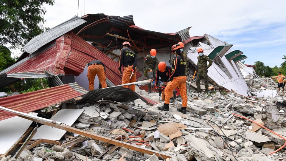
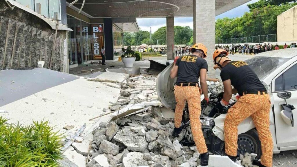
At least seven people were confirmed dead and several others injured after two powerful offshore earthquakes struck the southern Philippines on Friday, triggering tsunami warnings, infrastructure damage, and renewed concerns about the country’s seismic resilience.
Twin Quakes and Immediate Impact
The first tremor, recorded at magnitude 7.4, struck off the coast of Manay, Davao Oriental, sending shockwaves across Mindanao and prompting the Philippine Institute of Volcanology and Seismology (Phivolcs) to issue a tsunami alert for coastal areas within a 300-kilometer radius. Hours later, a second quake measuring 6.8 rattled the same region, leading to a new round of warnings.
Authorities urged residents near the shoreline to evacuate to higher ground, fearing waves up to one meter above normal tide levels. Although the tsunami alerts for both the Philippines and Indonesia were later lifted, officials warned of strong aftershocks in the coming days.
Local Devastation and Human Toll
Civil defense official Ednar Dayanghirang confirmed at least seven fatalities in areas close to the epicenter. Early assessments revealed damaged homes, churches, and bridges, particularly in Manay, where local disaster officer Richie Diuyen described the tremors as the strongest he had ever experienced.
“We couldn’t stand earlier. The ground moved so violently; roads cracked, and some bridges are now impassable,” Diuyen said.
Social media footage verified by Reuters showed vehicles shaking, metal gates rattling, and residents fleeing into open areas across the city of Davao.
Scientific Insight: A ‘Doublet’ Phenomenon
Phivolcs Director Teresito Bacolcol explained that the seismic activity constituted a “doublet” — a rare occurrence where two large quakes strike in the same region within a short time frame. This phenomenon, he noted, is characteristic of complex fault systems along the Philippine Trench, part of the Pacific “Ring of Fire” — one of the world’s most active seismic zones.
The depths of the two quakes were recorded at 23 km and 37 km, respectively, suggesting shallow, energy-intensive ruptures capable of generating widespread ground movement and sea disturbances.
National Response and Regional Context
President Ferdinand Marcos Jr. expressed condolences to the victims and assured that search and rescue teams were being mobilized. “We are working round the clock to ensure that help reaches everyone who needs it,” he said.
The disaster struck two weeks after another deadly quake killed 74 people on Cebu island, marking one of the Philippines’ deadliest seismic months in over a decade. Experts warn this may indicate increased tectonic stress along the eastern subduction zones, requiring enhanced monitoring and early-warning infrastructure.
Wider Implications: Preparedness and Resilience
The Philippines records an average of 800 earthquakes annually, yet the recurrence of large-magnitude tremors has reignited debate about urban preparedness and building code enforcement. Analysts note that the southern regions, though less urbanized than Luzon, remain particularly vulnerable due to limited evacuation infrastructure and coastal settlements.
International observers, including regional seismologists in Indonesia and Japan, are now monitoring whether the twin quakes could trigger further shifts along the Mindanao and Philippine trenches, potentially heightening seismic risks across the western Pacific basin.
While rescue operations continue, the dual earthquakes serve as a stark reminder of the Philippines’ fragile balance between geography and preparedness. As scientists study the “doublet” for clues on regional fault activity, local communities are left grappling with the human and infrastructural toll — a challenge that underscores the nation’s ongoing struggle to coexist with one of the most restless tectonic boundaries on Earth.
